
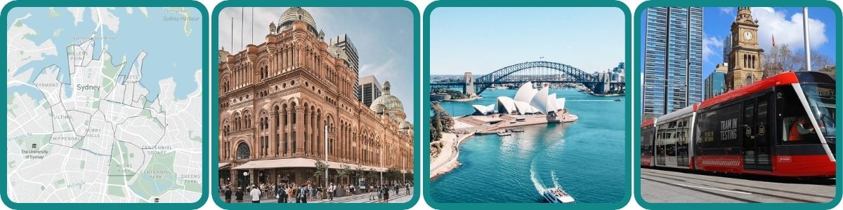
This is where Sydney began. On 26 January 1788, the First Fleet dropped anchor at Sydney Cove and European Australia started here, in what is now the CBD and its tight ring of inner suburbs. More than two centuries later, this remains the most commercially and culturally intense corner of the country.
But the Inner City is not one thing. The Rocks, Surry Hills, Chinatown, Glebe and Redfern are as different from each other as any four Sydney suburbs could be. Walk ten minutes in any direction and the whole mood changes: sandstone laneways give way to specialty coffee strips, then to roast duck hanging in restaurant windows, then to murals and the quiet weight of Aboriginal history. These transitions happen fast because density compresses everything.
What the inner suburbs share is walkability, energy, and a quality of life that residents in the outer suburbs quietly envy. You can get everywhere without a car. You can eat brilliantly every night of the week. The train network converges here, the ferries leave from here, and the city’s best arguments about food, culture, and politics happen here.
The Sydney Regions overview covers the broader picture. This guide goes deep into the CBD and Inner City specifically: its history, its distinct pockets, what it costs to live here, and how to make the most of it whether you are visiting for a weekend or planning a move.
Australian history, harbour views, cafe culture, Chinatown, LGBTQ+ scene, tech innovation
1788 (European settlement at Sydney Cove); Gadigal Country for tens of thousands of years prior
Walkability, dining, markets, history, nightlife, public transport access
Predominantly apartments; 24-hour energy in the core; village-like pockets in Glebe, Surry Hills, Redfern
Excellent: City Circle trains, 3 light rail lines, ferry hub at Circular Quay, dense bus coverage
High: CBD units from $924K median; 1-bed rental approx. $850/week
Diverse, dense, cosmopolitan; young professionals, students, long-term inner-city dwellers, Aboriginal community
The City of Sydney LGA covers 26.15 square kilometres across 28 suburbs. Compact on paper, but intensely packed. See the full list on our Sydney Suburbs by Municipality page.
The LGA runs from The Rocks and Circular Quay in the north, down through the CBD to Central Station, then fans out to Surry Hills and Darlinghurst to the east, Glebe and Ultimo to the west, and Redfern, Waterloo, Zetland and Rosebery in the south. The southern edge is genuinely fuzzy: Redfern and Alexandria sit within the LGA but are sometimes grouped with South Sydney depending on context.
This is one of the most densely populated areas in Australia. The CBD proper (the commercial high-rise core bounded by the harbour, Darling Harbour, Central Station, and Hyde Park) is distinct in everyday speech from the broader inner city, which includes all those residential inner suburbs beyond the towers.
European settlement began here in 1788. Sydney Cove is where the First Fleet landed, where convicts cleared land, and where the colony of New South Wales was established. The Rocks, the sandstone precinct on the western shore of the cove, is Australia’s most intact colonial streetscape.
It nearly wasn’t. In the early 1970s, the state government planned to demolish The Rocks entirely for luxury hotels and commercial development. Local residents formed the Rocks Residents Action Group and approached the NSW Builders Labourers Federation for help. Union leader Jack Mundey agreed. The BLF placed a green ban on The Rocks in 1971. Despite arrests and street riots in 1973, the ban held. The plans were shelved. This is one of the most significant acts of urban conservation in Australian history.
The CBD and inner suburbs are the most walkable part of Sydney, and it is not close. Town Hall, Wynyard, Central, Museum and St James train stations all sit within the City Circle loop. Three light rail lines cross the precinct. The ferry hub at Circular Quay connects to the rest of the harbour.
In practical terms: a car is genuinely unnecessary for daily life here. Locals know this, and it shows in the way the streets actually work. People walk. The footpaths are busy at all hours.
The inner suburbs are distinct communities that happen to share a postcode cluster. Surry Hills has a different character from The Rocks. Chinatown is nothing like Glebe. Redfern is its own world, layered and contradictory in ways that take time to understand.
Because the density is so high, these transitions happen within walking distance. You can move through four completely different urban atmospheres in 30 minutes on foot. Visitors consistently find this surprising.
Australia’s largest innovation district is taking shape between Central Station and Camperdown. The 2025-26 NSW Budget committed $38.5 million to Tech Central as part of an $80 million Innovation Blueprint 2035. The Atlassian global headquarters tower is under construction nearby. Canva is headquartered close by.
The target is 25,000+ jobs across the precinct. The Redfern-Eveleigh corridor is where the activity is anchored. Calling it Sydney’s answer to Silicon Valley is not hyperbole at this point; it is planning policy.
Redfern holds two realities at once, and neither cancels the other out. It is one of Sydney’s most significant sites of Aboriginal culture and community: The Block, the Aboriginal Medical Service, the Aboriginal Legal Service, and the Aboriginal Housing Company were all founded here, making Redfern the birthplace of the urban Aboriginal civil rights movement.
It is also one of Sydney’s fastest-gentrifying inner suburbs. Cafes, wine bars, and a growing tech and creative industry presence now sit a short walk from The Block’s history and the Pemulwuy Aboriginal Housing Project. These two identities coexist, sometimes uneasily, and understanding both is part of understanding the suburb.
1788: Sydney Cove and the Beginning
On 26 January 1788, 11 ships of the First Fleet arrived at Sydney Cove carrying 750 convicts and around 400 soldiers, officials, and settlers. Captain Arthur Phillip established the colony of New South Wales here, marking the beginning of permanent European settlement in Australia.
What that arrival meant for the Gadigal people of the Eora Nation, the traditional custodians of this country, was dispossession. The Gadigal had lived on this harbour for tens of thousands of years. European settlement brought disease, displacement, and the destruction of a way of life. That history sits beneath every sandstone block in The Rocks and every street in the CBD. It is part of what this place is.
The convicts who landed built wattle-and-daub huts, then later cut the sandstone that became Sydney’s first permanent buildings. The Rocks takes its name from that sandstone outcrop on the western shore of the cove. The area remained a rough working-class waterfront precinct through the 19th and early 20th centuries, populated by sailors, wharfies, and the families who depended on the harbour for work.
The Green Bans: 1970-1974
By the early 1970s, the NSW state government had plans to demolish The Rocks entirely and replace it with luxury hotels and commercial towers. Local residents formed the Rocks Residents Action Group and approached the NSW Builders Labourers Federation (BLF) for help. Union leader Jack Mundey agreed.
The BLF placed a green ban on The Rocks in 1971: its members would not work on any demolition or development in the area. Despite arrests and street riots in 1973 as police moved to enforce demolition work, the ban held. The plans were shelved. Between 1971 and 1974, the BLF imposed 54 green bans across NSW covering The Rocks, Glebe, Woolloomooloo, Centennial Park, and other threatened areas. Green bans saved more of Australia’s built heritage in three years than any government policy had managed in decades. Jack Mundey was jailed. The buildings survived.
The term “green ban” was coined for this campaign. It was the first time environmental and community concerns, not just wages and conditions, were the explicit basis for union industrial action. The Rocks you walk through today exists because of it.
Redfern: The Block and an Ongoing Story
In the early 1970s, Aboriginal people migrating from rural NSW to Sydney concentrated in Redfern. In 1972, the Whitlam government made a grant to purchase housing in a block bounded by Eveleigh, Caroline, Louis, and Vine Streets. The Aboriginal Housing Company was established to manage what became known as The Block.
From The Block came the Aboriginal Medical Service (1971), the Aboriginal Legal Service (1970), and the foundations of Australia’s first community-controlled Aboriginal services. Redfern became the hub of urban Aboriginal civil rights. The 1988 Royal Commission into Aboriginal Deaths in Custody and Prime Minister Paul Keating’s 1992 Redfern Park Speech, delivered to the Aboriginal community gathered there, are among the most significant moments in modern Australian political history.
Today, Redfern holds that history alongside the rapid change of gentrification and the construction of Tech Central nearby. The Pemulwuy Aboriginal Housing Project, developed by the Aboriginal Housing Company, is one response to that pressure. The suburb’s dual identity is not a contradiction to resolve but a reality to understand.
From the airport: The T8 Airport & South Line runs from Sydney Airport to Central Station in about 13 minutes, and to Circular Quay in about 18 minutes. The adult fare is approximately $19.94 including the station access fee. Trains run every 10 minutes from 5am to midnight. Use an Opal card or contactless payment. See the full Sydney Transport guide for more detail.
Within the inner city: Walking is the most practical option for most trips. Circular Quay to The Rocks is 10-15 minutes on foot. Town Hall to Darling Harbour is a 10-minute walk. Central to Surry Hills is 15-20 minutes.
Light rail: The L2 and L3 lines run from Circular Quay along George Street to Central and beyond, with stops through Haymarket. Services every 4 minutes at peak.
- Paddy’s Markets: Open Wednesday to Sunday, 10am-6pm. Located at 9-13 Hay Street, Haymarket, inside the Market City shopping centre.
- New Sydney Fish Market: Opened January 2026 at Blackwattle Bay, Pyrmont. 40+ food operators, 6,000sqm of public open space. Accessible by light rail (Fish Market stop). Go on a weekday morning if you can: busy by 10am on weekends.
- Glebe Markets: Every Saturday, 10am-4pm, on the grounds of Glebe Public School on Glebe Point Road. A genuinely local institution.
- Surry Hills: Best explored on foot from Central Station. Crown Street is the main strip; Bourke Street and Cleveland Street are worth the detour.
- Chinatown: Busiest on weekends, particularly evenings. Dixon Street pedestrian mall is the centre; the food courts in the surrounding buildings go deeper than they look.
- Best areas to stay by interest: Circular Quay and The Rocks for harbour access and tourism convenience; Surry Hills or Darlinghurst for cafe culture and nightlife; Haymarket for budget accommodation near Chinatown; Pyrmont for the new Fish Market and waterfront atmosphere.
The resident mix reflects everything the inner city is. Young professionals take up tower apartments in Barangaroo, Pyrmont, and Surry Hills. International and domestic students fill Ultimo (UTS, TAFE), Glebe (near USYD), and Haymarket (language colleges). Long-term inner-city dwellers, some of whom have been in Glebe or Darlinghurst for decades, watch the neighbourhood change around them with a mix of appreciation and resignation. The Aboriginal community in Redfern, the tech and creative workers in Eveleigh and Alexandria, and the hospitality and arts workers spread across every precinct all share these streets.
The overseas-born proportion of the population is very high, particularly in the CBD and Haymarket. This is one of the most genuinely international urban zones in the country. You’ll find it in the languages spoken on trains, in the breadth of the food available, and in the range of cultural events across any given month.
The city never fully quiets. CBD apartments are small by international standards. Noise, proximity, and a lack of private outdoor space are the trade-offs for everything else this location offers. Locals know what they are signing up for.
The walkability catches most visitors off guard. You can walk from Circular Quay to Surry Hills in 20 minutes. The Rocks to Chinatown is about the same. People arriving with a full day’s Opal card loaded often find they barely use it.
How different each pocket feels is the other consistent surprise. The Rocks and Chinatown are ten minutes apart and feel like different cities. Visitors who haven’t been to Redfern for ten years find a suburb they don’t quite recognise. The Glebe foreshore walk sits largely unknown to tourists, despite being an easy stroll from the new Fish Market at Pyrmont.
The new Sydney Fish Market at Blackwattle Bay, Pyrmont (opened January 2026) has immediately become a destination in its own right. 40+ food operators, a generous public waterfront space, and genuine architectural ambition. Pyrmont’s transformation is continuing: a $900 million residential development and new planning controls targeting 4,500+ homes and 23,000+ jobs signal what the suburb looks like in five years.
Tech Central is building momentum with real infrastructure behind it. The Atlassian tower is under construction. The 2025-26 budget commitment of $38.5 million is part of a broader $80 million Innovation Blueprint 2035. Barangaroo’s waterfront dining and public space offer is maturing into something Sydney residents actually use, not just visit.
Density and convenience come with noise and space constraints. CBD apartments are small and the city never fully quiets: even at 3am, there is truck delivery noise, distant sirens, and the hum of HVAC systems in the towers around you.
The gentrification of Surry Hills, Darlinghurst, and Redfern has displaced some long-term communities and changed the character of streets that once had a rougher but more economically mixed identity. Parking is expensive, ranges from difficult to impossible in most precincts, and is largely unnecessary if you embrace what the transport network actually offers.
What suburbs are in the Sydney CBD and Inner City?
The City of Sydney LGA contains 28 suburbs: Alexandria, Barangaroo, Beaconsfield, Centennial Park, Chippendale, Darlinghurst, Darlington, Dawes Point, Elizabeth Bay, Erskineville, Eveleigh, Forest Lodge, Glebe, Haymarket, Millers Point, Moore Park, Newtown, Potts Point, Pyrmont, Redfern, Rosebery, Rushcutters Bay, Surry Hills, Sydney CBD, The Rocks, Ultimo, Waterloo, Woolloomooloo, and Zetland. In everyday conversation, the CBD typically refers to just the commercial core: George Street, Martin Place, Pitt Street Mall, and Circular Quay.
Is Surry Hills part of the Inner City?
Yes. Surry Hills is fully within the City of Sydney LGA and is one of the region’s most distinctive suburbs: the cafe capital of Sydney and a hub for creative industries. It borders the CBD to the east and sits 10-15 minutes walk from Town Hall or Central stations.
Is Redfern safe to visit?
Redfern has changed considerably in the past decade. It has gentrified substantially, with excellent cafes, wine bars, and a growing tech and creative industry presence. The suburb does have higher crime statistics than the Sydney average, and some parts, particularly around The Block area at night, call for the same street awareness you would apply in any inner-city neighbourhood. For most visitors and residents going about daily life, Redfern is safe and increasingly desirable.
What is the best area to stay in the Sydney CBD?
It depends on what you are here for. Circular Quay or The Rocks for harbour access and tourism convenience. Surry Hills or Darlinghurst for cafe culture, dining, and nightlife. Haymarket for budget-friendly accommodation near Chinatown and Asian food. Pyrmont for waterfront atmosphere and the new Fish Market. The central CBD near Park Street for Hyde Park and city-centre convenience.
Is Glebe part of the CBD?
Glebe is within the City of Sydney LGA but is not part of the CBD. It sits west of the CBD, bordered by Ultimo, Forest Lodge, and Annandale. The character is quite different: cafes, markets, bookshops, and a village pace rather than commercial density. You’ll find it around 15-20 minutes by bus or 25 minutes on foot from the CBD core.
What is The Rocks known for?
The Rocks is Australia’s oldest European precinct, where the First Fleet landed in 1788. It is known for its preserved colonial sandstone buildings, heritage pubs among the oldest in Australia, weekend markets, and direct views of the Harbour Bridge. It was saved from demolition in the 1970s by union-led green bans organised by Jack Mundey and the NSW Builders Labourers Federation. The Rocks Discovery Museum covers the full history from Aboriginal habitation through the green ban campaign.
The CBD and Inner City is where you start understanding Sydney. Explore the full Sydney Regions guide to see how this area connects to the rest of the city.
Sydney suburb rankings: Most Expensive Suburbs in Sydney | Best Suburbs to Live in Sydney