
At first glance, using Sydney’s transport system may seem very complicated, but actually, in recent times it has become much simpler to get anywhere, and I’m going to explain it all for you. Sydney has one of the most complete public transport networks in the Southern Hemisphere. Nine train lines, a driverless Metro, three light rail routes, ten ferry routes, and thousands of bus services – all on a single Opal card, all connected, all counting toward the same fare cap. Here’s how it all fits together.
TLDR – Getting Around Sydney on Public Transport
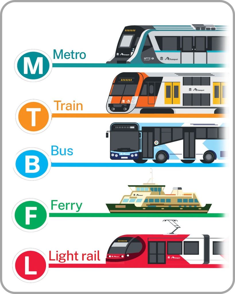
Sydney’s public transport network is built around trains, metro, buses, ferries and light rail, with each mode colour-coded and easy to follow using the official transport app, which makes journey planning easy.
How to pay? For short-term visitors and daily commuters, contactless payment (more below) or an Opal card makes getting around simple; simply tap on as you board and tap off as you exit. The fare is automatically deducted from your balance.
Your Opal card works across all modes of transport, train, bus, ferry, metro and light rail. Cost-wise, a short 7-minute journey will cost around $3, and there are daily caps and weekly caps after which you won’t be charged.
The train network is the backbone of getting most anywhere and is the most useful to understand first. If you’re staying mainly in the CBD, you only really need to know the T1 North Shore & Western Line, T2 Leppington & Inner West Line, and T8 SYD Airport & South West Line (called the T8 Airport & South Line until 15 November 2026).
How many lines and routes are there?
| Train Lines | 9 |
| Metro Lines | 4 |
| Light Rail Routes | 3 |
| Ferry Routes | 10 |
| Bus Routes | 850+ |
Now let’s go into more detail on how everything works.
The Opal Card – One Card, Every Mode

Everything runs on the Opal card – a reusable smartcard you tap on when you board and tap off when you exit. It works on trains, Metro, light rail, ferries, and buses. Pick one up at any train station ticket machine, ferry wharf, or convenience store displaying the Opal logo. If you’d rather not carry a card, tap a contactless Visa, Mastercard, or Amex, or use your phone or watch – most services accept these too.
Fares are calculated by distance and capped. For example, the 7-minute journey from Sydney CBD to Circular Quay will cost around $3. The daily cap is $19.30 Monday to Thursday and $9.65 Friday to Sunday and public holidays. The weekly cap is $50. Transfers between any two services within 60 minutes attract a $2 discount, so a train-to-bus or ferry-to-light-rail connection doesn’t cost you a second full fare.
Download the Transport for NSW app (see essential apps further below) before you arrive. It shows real-time departures, journey planning, and your Opal balance in one place – and it handles service disruptions far better than Google Maps. Set up trip notifications and you’ll never miss a platform change.
Insider tip: Full Opal Card guide — fares, daily and weekly caps, contactless payment, concessions →
Sydney Trains – The Backbone of the Network
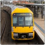
Sydney Trains operates nine colour-coded suburban lines fanning out from the City Circle – an underground loop connecting Central, Town Hall, Wynyard, Circular Quay, St James, and Museum stations. If you’re new to Sydney, learn these six stations first: every line either passes through or terminates at one of them.
The network covers 169 stations and carries around 270 million passengers a year. Most visitors use the T1, T4, and T8 most often – the T1 for the Harbour Bridge and Blue Mountains, T4 for Bondi, and T8 for the airport. Intercity services on the new Mariyung fleet, which we’ll cover further on, extend the reach to the Blue Mountains, South Coast, and Newcastle. A new timetable for the T4, T8, South Coast and T2 lines starts on Sunday 15 November 2026, so if you use those lines, re-check your regular trips in Trip Planner.
| Line | Colour | Details |
|---|---|---|
| T1 – North Shore & Western | Yellow | Richmond and Emu Plains to Berowra and Hornsby via Parramatta and the Harbour Bridge. Your line for the Blue Mountains, Parramatta heritage, and the famous free bridge crossing – sit on the right heading north for Opera House views. Full T1 guide → |
| T2 – Leppington & Inner West | Aqua | Leppington and Liverpool through Newtown, Redfern, and the City Circle. The inner west café culture and live music line. Interchange to Metro City & Southwest at Sydenham. Full T2 guide → |
| T3 – Liverpool & Inner West | Orange | Liverpool via Regents Park and Homebush to the City Circle. Note: the former Bankstown branch closed in October 2024 as part of the Metro conversion – travel to Bankstown now via the Metro City & Southwest. Full T3 guide → |
| T4 – Eastern Suburbs & Illawarra | Dark Blue | Bondi Junction through Martin Place, Town Hall and Central, then south via Sydenham and Hurstville to Cronulla and Waterfall. The essential tourist line – take T4 to Bondi Junction, then bus 333 or 380 to the beach – and the train to Cronulla’s beaches and the Sutherland Shire. From 15 November 2026, St Peters and Erskineville join the line, every T4 train stops at Sydenham for the Metro, and peak trains run more often. Full T4 guide → |
| T5 – Cumberland | Purple | A lateral western Sydney connector from Leppington through Parramatta to Schofields and Campbelltown – no CBD access. Useful for crossing western Sydney without routing through the city. Full T5 guide → |
| T6 – Lidcombe & Bankstown | Brown | Short spur from Lidcombe to Bankstown via Cabramatta – a genuine local gem. Cabramatta is home to some of Sydney’s best Vietnamese food and is well off the tourist trail. Full T6 guide → |
| T7 – Olympic Park | Grey | Event shuttle from Lidcombe to Sydney Olympic Park. Only runs on event days and some regular services – always check the timetable before going. Interchange from T1 at Lidcombe. Full T7 guide → |
| T8 – SYD Airport & South West | Green | City Circle to the Domestic and International airport stations, then via Wolli Creek and Glenfield to Macarthur. Called the T8 Airport & South Line until it’s renamed on 15 November 2026, when every T8 train starts running through the airport, with peak trains every four minutes between Green Square and Wolli Creek. About 13 minutes from Central to the International terminal. Budget for the airport station access fee ($18.61 per adult trip as of October 2026) – it’s automatic on Opal and applies on top of your regular fare. Full T8 guide → |
| T9 – Northern | Red | Strathfield to Berowra via Epping – the inland twin to the T1 and generally less crowded. Good for Epping (Metro interchange), Hornsby, and the start of the Berowra Waters bushwalking area. Full T9 guide → |
Read More: Full Sydney Trains Guide & Maps →
Sydney Metro – Driverless, Frequent, and Growing Fast
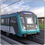
The Sydney Metro is Australia’s first fully automated, driverless rapid transit network. Unlike Sydney Trains, Metro stations don’t have staffed gates – you tap on and off at platform barriers, and trains run every four minutes during peak hours. No timetable needed. It integrates fully with Opal and all the same fare caps apply.
As of 2026 the network has three operational lines covering the northwest, the city, and the inner south. A fourth line connecting western Sydney to the new Badgerys Creek airport is under construction with trains expected from 2027.
| Line | Colour | Details |
|---|---|---|
| M1 – Metro Northwest | Teal | Tallawong to Chatswood – Australia’s first Metro line, opened May 2019. Thirteen stations through Sydney’s rapidly growing northwest corridor: Rouse Hill, Norwest, Bella Vista, Hills District to Chatswood. Connects to the City & Southwest at Chatswood for through-running into the city. |
| M1 – Metro City & Southwest (Chatswood–Sydenham) | Teal | The 2024 city extension: Crows Nest, Victoria Cross, Barangaroo, Martin Place, Pitt Street, and Waterloo. These are brand-new stations with architecturally ambitious design – Martin Place’s 40-metre underground atrium is worth seeing. Interchange to T4 trains at Martin Place for Bondi Beach. |
| M1 – Metro City & Southwest (Sydenham–Bankstown) – Opening 2026 | Teal | The final section of the City & Southwest extension, converting the former T3 Bankstown line through 10 stations (Marrickville to Bankstown) to full Metro standard. Opening in 2026, this will complete the through-running Metro service from Tallawong all the way to Bankstown. |
Read more: Sydney Metro Line Guide & Map → | Sydney Airport Metro Line
Light Rail – George Street and Beyond
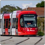
Sydney’s light rail network covers the CBD’s main spine on George Street, the university and eastern suburbs corridor, and the inner west.
All three lines use Opal, run frequently, and connect seamlessly with trains at Circular Quay, and with trains and Metro at Central.
| Line | Colour | Details |
|---|---|---|
| L1 – Inner West Line | Red | Central (Grand Concourse) to Dulwich Hill via Darling Harbour, Pyrmont, Glebe, and Leichhardt. 23 stops across 12.8 km. The Inner West line runs through some of Sydney’s most creative neighbourhoods and is the only rail link to Darling Harbour from the west. |
| L2 – Randwick Line | Red | Circular Quay to Randwick via George Street, Central, Surry Hills, and Moore Park. The quickest way to reach Royal Randwick Racecourse and UNSW. George Street stops put you in the heart of the CBD shopping strip – convenient, frequent, and completely car-free along the city section. |
| L3 – Kingsford Line | Red | Circular Quay to Kingsford via the same CBD corridor as L2, splitting at Anzac Parade. Serves Kingsford and the eastern suburbs sporting precincts. Both L2 and L3 stop at the Sydney Cricket Ground and Allianz Stadium – the default transport for big match days. |
Read more: Full light rail guide with map →
Ferries – Harbour Views on an Opal Fare
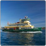
Sydney Ferries operate ten routes from Circular Quay and offer some of the best value sightseeing in the city, all included in your Opal transfer window and daily cap.
The Manly Ferry in particular is a rite of passage, offering a 30 minutes across the open harbour, with the Bridge and Opera House visible from the top deck, for the price of a standard Opal fare.
| Route | Departure | Details |
|---|---|---|
| F1 – Manly Ferry | Wharf 3 | The iconic 30-minute harbour crossing from Circular Quay Wharf 3 to Manly. Stay on the outer deck for the full experience – open-ocean swell, the heads, the Bridge receding behind you. Runs regularly throughout the day including evenings. A fast ferry option also operates with a shorter crossing time for a slightly higher fare. |
| F3 – Parramatta River | Circular Quay | The full harbour-to-river journey from Circular Quay to Parramatta via Olympic Park, Meadowbank, and Rydalmere. One of Sydney’s great slow journeys – the river narrows as you head west, past mangroves, boat sheds, and Sydney’s working waterway life. Allow 2+ hours for the full run. |
| Other Routes | Circular Quay | Taronga Zoo (F2), Balmain and Cockatoo Island (F4), Neutral Bay and Mosman (F5, F6), Double Bay and Watsons Bay (F7), Darling Harbour (F8), Pyrmont (F9). All depart from Circular Quay wharves 2–6. The zoo ferry arrives directly at the lower zoo entrance – no hill climb. |
Read More: Full ferries guide – all routes, wharves, and tips →
Buses – The Network That Fills the Gaps
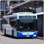
Sydney’s bus network covers over 300 routes and reaches every corner of the city that trains and ferries don’t. Some routes run 24 hours.
Key tourist routes include the 333 and 380 to Bondi Beach from Bondi Junction, the B-Line rapid bus to the Northern Beaches from Wynyard, and the 555 free CBD shuttle that loops through the city centre.
A rapid bus service from Wynyard or Broadway to Mona Vale, Dee Why, and Manly – limited stops, frequent, and standing-room only on Friday evenings. For the Northern Beaches (Freshwater, Curl Curl, Narrabeen), the B-Line followed by a local bus is the only public transport option. Check the Transport for NSW app for connections.
Read More: Full public bus guide & map →
Regional Trains – Blue Mountains, South Coast, Newcastle
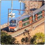
NSW TrainLink intercity services connect Sydney to the state’s most scenic destinations – now running on the brand-new Mariyung fleet.
Named for the Darug word for emu, the Mariyung trains bring 2×2 seating, charging ports at every seat, dedicated luggage spaces, and air conditioning that works properly. All depart from Central Station.
| Line | Route | Details |
|---|---|---|
| Blue Mountains Line | Central → Lithgow · Mariyung | Sydney’s most popular train day trip. Climbs through World Heritage-listed wilderness to Katoomba (2 hours) – gateway to the Three Sisters, the Jamison Valley, and some of NSW’s finest walking trails. The descent past Mount Victoria to Lithgow is one of the best pieces of mountain railway in eastern Australia. |
| South Coast Line | Central → Kiama · Mariyung from April 2026 | The Mariyung fleet launched on the South Coast Line on 14 April 2026. Wollongong (1.5 hours), Royal National Park coastal corridor, Thirroul, and Kiama. From 15 November 2026, peak trains from Wollongong run every 15 minutes and off-peak and weekend trains every 30 minutes, but South Coast trains end at Central (no more through-running to Bondi Junction) and no longer stop at Wolli Creek – for the airport, change to the T8 at Central. |
| Central Coast & Newcastle Line | Central → Newcastle · Mariyung | North through Hornsby, over the spectacular Hawkesbury River, past Gosford and Brisbane Water to Newcastle Interchange (2.5 hours). Newcastle’s waterfront revival makes this an excellent weekend destination – beach at the end of the main street and great food. |
Read More: Full regional trains guide – all routes and day trip ideas →
Taxi, Rideshare & Limo – When You Need a Door-to-Door Option
Taxis are metered, regulated, and available 24/7 across Sydney – flag one on the street, find them at ranks outside major hotels and the CBD, or book via the 13CABS or Ingogo apps. Rideshare (Uber, Ola, DiDi) operates city-wide and is generally the more convenient option for late nights and areas with limited public transport. Fares surge during peak events and wet weather.
For airport transfers, premium occasions, and corporate travel, licensed limousines and chauffeur services offer fixed-rate bookings – useful when you need reliability over price.
- Taxis: Metered, regulated, 24/7. Flag on the street or book via app. Surcharges apply for airport trips and late nights.
- Rideshare: Uber, Ola, and DiDi operate city-wide. Most practical for late nights, the Northern Beaches, and anywhere without a train. Prices surge on event nights – book early or allow extra time.
- Limousines: Fixed-rate chauffeur transfers for airport runs, corporate travel, and special occasions. Book in advance for guaranteed vehicles and no surge pricing.
Cars & Bikes – When You Want to Drive or Ride
Sydney’s inner city is genuinely easier by public transport – parking is expensive, CBD congestion is real, and on a weekend the train will beat the car to most destinations. But for day trips beyond the rail network – the Hunter Valley wineries, Southern Highlands, or the Blue Mountains’ outer reaches – a car makes sense. All major rental companies operate from the airport and city locations.
- Car Rental: All major companies at the airport and city. Book ahead for weekends and holiday periods – Sydney prices move fast when stock runs low.
- Car Sharing: By-the-hour car hire via GoGet and Flexicar. Good for short trips where a full rental day makes no sense – beach days, grocery runs, or getting somewhere the train doesn’t go.
- Campervan Rental: Sydney is an excellent base for east coast road trips north to Byron Bay or south to Melbourne. Multiple operators at the airport – book well ahead in summer and school holidays.
- Bike Rental: Hire a bike and explore the harbour foreshore, Centennial Park, or Manly’s beachside paths. Manly to Spit Bridge on two wheels is a classic – mostly flat, harbour views the whole way.
Essential Sydney Transport Apps – What to Have on Your Phone
- Opal Travel App – The official Transport for NSW app is the single most useful tool for getting around Sydney offering real-time departures, journey planner, Opal balance, and disruption alerts all in one place.
- Trip Planner – If you dont want to download an app, there’s an online version of the journey planner
- Google Maps – excellent for quickly comparing public transport routes, walking connections and travel times.
- For ferries specifically, TripView shows ferry departures with a clarity the official apps sometimes lack.
Read More: Full transport apps guide →