
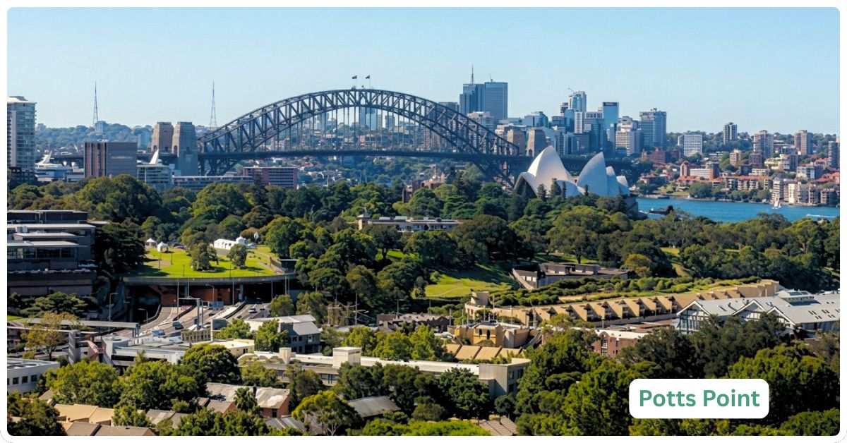
Potts Point runs on a trade you either accept or you don’t: Art Deco romance and a harbour glimpse in exchange for a postage-stamp footprint, almost no green space of its own, and a southern border that bleeds straight into Kings Cross’s long tail of late-night noise. It is one of the most architecturally dense square kilometres in Sydney, a place where 1920s and 1930s apartment blocks with terrazzo lobbies and wrought-iron balconies sit shoulder to shoulder along streets built for horse traffic, not for the 4WDs that now try to park on them. Macleay Street still does the cafe-and-restaurant strip thing better than most of the inner city manages, and El Alamein Fountain still marks the spot where the postcode’s reputation softens from red-light-adjacent to elegant. Whether that combination reads as character or as compromise depends entirely on how much floor space and quiet you need.
Potts Point Boundary and Location Map
Potts Point sits roughly 2.5 kilometres east of the Sydney CBD, occupying the tip of a small peninsula between the harbour and Kings Cross. It’s bordered by Elizabeth Bay to the east and south-east, Kings Cross to the south, Woolloomooloo to the west across the escarpment, and Rushcutters Bay a little further south-east. Confirmed via NSW Spatial Services boundary data, Potts Point sits within the City of Sydney local government area and shares postcode 2011 with Elizabeth Bay and Rushcutters Bay, though each is a distinct, separately recognised suburb.
Quick Facts
| LGA | City of Sydney |
| Postcode | 2011 |
| Population | 7,183 at the 2021 Census (ABS SAL13268), down from 9,428 in 2016, a 23.8% fall attributed largely to short-term rental conversion and pandemic-era vacancy; no updated ABS figure exists yet, next Census due 2026/27 |
| Growth Rate | Declining over 2016-2021 (-23.8%); trend since has not been formally re-measured, treat with caution until the next Census count lands |
| Distance from CBD | Approximately 2.5km east of the Sydney CBD |
| Character | Dense, heritage Art Deco apartment suburb with a cafe strip, harbour glimpses, and a nightlife-edge southern border |
| Median House Price | $6.5 million (Your Investment Property Magazine, May 2026), but based on just 13 sales in 12 months, a thin, heritage-terrace-skewed sample that should not be read as a representative “house market” |
| Median Unit Price | $920,000, up 14.14% over the year to May 2026, on 250 sales (Your Investment Property Magazine, May 2026) |
| Transport | Kings Cross railway station (T4 Eastern Suburbs & Illawarra Line) sits on the suburb’s southern edge; buses run along Macleay Street and William Street into the CBD |
| Crime Rate (LGA) | City of Sydney LGA recorded roughly 19,852 incidents per 100,000 people in the year to March 2026 (BOCSAR), higher than the state average but down 4% over five years; heavily distorted by the LGA’s huge non-resident, nightlife and tourist population, see Crime and Safety below |
| Childcare Availability | Tight. A handful of long day care centres exist locally (see Childcare below), but supply is limited by the suburb’s near-total apartment stock and low child population |
| School Zone Quality | Thin. The suburb has no secondary school of its own and only a nearby government primary option; most resident families look to nearby Darlinghurst, Woolloomooloo or independent schools rather than a strong local zone |
| Parks & Recreation | Fitzroy Gardens (El Alamein Fountain) is the suburb’s own green space; Beare Park and the Butler Stairs harbour lookout are a short walk away in Elizabeth Bay |
| Shopping | Macleay Street strip for cafes, restaurants, delis and boutiques; no major shopping centre, Woolworths Metro and IGA-style convenience only |
| Health | St Vincent’s Hospital, Darlinghurst is the nearest major public hospital, a short walk or bus ride away; several GP clinics operate within the suburb itself |
| Best For | Young professionals, downsizers and singles who want inner-city walkability and heritage character and don’t need a car, a yard or a school zone |
What Makes Potts Point Special
Art Deco Heritage and the Macleay Street Cafe Strip
Potts Point has one of the best-preserved concentrations of interwar apartment architecture in Australia, a legacy of the 1920s and 1930s building boom that gave the suburb its terrazzo foyers, curved balconies and wrought-iron detailing. Walk Macleay Street on a Saturday morning and the suburb does its best trick: cafe tables spilling onto the footpath, independent delis, a mix of long-standing locals and newer arrivals, all inside a five-minute stretch of road. It’s a strip that has survived multiple waves of Sydney hospitality fashion without losing its identity, which is more than can be said for most inner-city high streets.
Fitzroy Gardens, El Alamein Fountain and the Butler Stairs
Fitzroy Gardens, on the site of Alexander Macleay’s 1841 estate, is compact but does real work as the suburb’s green lung. Its dandelion-shaped El Alamein Fountain, designed by Robert Woodward and Phil Taranto and built in 1961 to commemorate the 9th Division AIF, has become a visual shorthand for the whole precinct (City of Sydney, Fitzroy Gardens history page). From the eastern edge of the suburb, the Butler Stairs drop down toward Elizabeth Bay and deliver one of the better free harbour views in the inner city, no admission fee, no queue, just a set of public stairs most tourists never find.
The Self-Made Bank Porter the Suburb Is Named For
Potts Point’s name has nothing to do with the shape of the land and everything to do with a scrappy nineteenth-century success story. Joseph Hyde Wylde arrived as, in effect, the Bank of New South Wales’s live-in night watchman: when the bank opened for business in 1817, he was taken on as “porter and servant,” sleeping on the premises to guard the strong-box in exchange for rations from the King’s store and a salary of £25 a year. The bank’s officers had one hard rule for junior staff: no marrying. When Wylde fell for a young woman and asked permission to bring her to live with him at the bank, the board refused, and, deciding his future lay with the job rather than the engagement, poor Wylde called the wedding off. Fifteen years and a promotion to bank accountant later (he’d designed the bank’s own banknotes along the way), Wylde was finally granted ten days’ leave, used it to marry Emma Bates, who had arrived in the colony the year before, and put his accumulated salary toward 6½ acres of harbourside land at the tip of the peninsula, land that had originally been part of an 1822 grant to Judge-Advocate John Wylde (no relation, and the reason nearby Wylde Street carries the name too). He called his new property Potts Point, and it stuck to the whole suburb (Francis Pollon, “The Book of Sydney Suburbs,” 1988).
Before the land grants arrived, the point carried other names entirely, among them Paddy’s Point, Kurrajen (or Currageen) and Yarrandabbi, the latter two believed to be Aboriginal place names. “Paddy” is thought to have been Patrick Walsh, who received a 30-acre grant here in 1809 during the brief period between Governor Bligh’s departure and Governor Macquarie’s arrival, a grant Macquarie later declined to confirm, sending the land back to the Crown. What did survive is a run of colonial heritage: architect John Verge designed both Tusculum at 3 Manning Street (built 1831-35) and Rockwall at 7 Rockwall Crescent (built on an 1831 grant to engineer John Busby, later absorbed into the Chevron Hotel complex and since restored), while the Minerva Theatre on Orwell Street opened in 1938-39 and Tarana on Wylde Street dates to around 1889 (Pollon, 1988). And “point” is technically no longer accurate: the peninsula was physically joined to Garden Island in 1942 during construction of the Captain Cook Dock, closing the water gap between two pieces of land that had been separate since the navy first established a depot on Garden Island in 1866 (Pollon, 1988).
What Is It Like Living Here?
Life in Potts Point is a walking life. Most residents don’t own a car, don’t need one, and structure their week around what’s within ten minutes on foot: the office, the gym, the cafe, the late bar. It suits people who value proximity over space, and it will frustrate anyone who wants a spare room, a car space that isn’t a $1 million-plus premium, or a quiet street after 11pm on a Friday.
Transport
Kings Cross railway station sits right on Potts Point’s southern boundary and runs on the T4 Eastern Suburbs & Illawarra Line, putting the CBD (Martin Place/Town Hall) roughly 5-7 minutes away by train. It’s one of the suburb’s strengths: few inner-city apartment suburbs offer a heavy-rail station this close.
Buses run along Macleay Street and William Street, connecting into the CBD and out toward Bondi Junction and the eastern suburbs, useful backup for the stretches of the suburb further from the station.
William Street doubles as the main road artery, feeding into the Cross City Tunnel and giving quick car access toward the CBD and the eastern suburbs, though residents rarely need it day to day.
Healthcare
St Vincent’s Hospital, Darlinghurst is the nearest major public hospital, a short walk or a couple of stops away, with St Vincent’s Private also on the same campus. Potts Point itself has a scatter of GP clinics and specialist rooms, reflecting the density of professional residents who want healthcare within walking distance rather than a drive.
Schools and Childcare
This is the honest weak point. Potts Point has no secondary school and no dedicated primary school of its own; the nearby government option is Plunkett Street Public School in neighbouring Woolloomooloo, which serves this pocket of the inner city. Families needing a stronger zoned option, or wanting independent or Catholic schooling, generally look toward Darlinghurst, Paddington or the broader eastern suburbs corridor. This isn’t a defect so much as a reflection of who actually lives here: with only 30.6% of households counted as families at the 2021 Census, school-age demand simply isn’t the driver of local infrastructure the way it is in a family suburb further out.
Childcare tells the same story. A small number of long day care centres operate in and around Potts Point and Kings Cross (listed on the ACECQA national register), but supply is tight relative to what you’d find in a suburb with more family-sized housing stock, and most options sit just outside the suburb boundary in Elizabeth Bay, Darlinghurst or Woolloomooloo.
Industry & Work Life
Most working residents commute a short distance into the CBD or fill roles in the professional, hospitality and creative sectors that cluster around inner Sydney. The suburb’s own economy leans heavily on hospitality: cafes, restaurants and bars along Macleay Street employ a meaningful share of the local workforce, and the proximity to Kings Cross’s nightlife precinct adds shift work in bars and venues to the mix. It’s a suburb built around walkable, short commutes rather than a single dominant local industry.
Shopping & Eating Out
Macleay Street is the suburb’s spine and its main event: a deep run of cafes, bistros and restaurants including long-running local favourites such as Macleay St Bistro, alongside newer arrivals reviewed regularly by The Urban List and Sydney.com’s Potts Point and Woolloomooloo dining guide. There’s no major shopping centre; grocery needs run through Woolworths Metro-style convenience stores and delis rather than a full-line supermarket, which is standard for a suburb this dense and this small.
Attractions, Parks and Natural Spaces
Fitzroy Gardens, home to the El Alamein Fountain, is the suburb’s own patch of green and its most photographed corner. Beare Park, technically across the boundary in Elizabeth Bay, is close enough to function as a de facto local park, with harbour frontage and space to actually stretch out, something Potts Point’s own footprint doesn’t offer.
The Butler Stairs deliver a free harbour lookout on the walk down toward Elizabeth Bay. For anyone wanting proper parkland rather than a pocket garden, the Royal Botanic Garden and the Domain are a manageable walk west via Woolloomooloo.
Crime and Safety
Potts Point’s reputation is tangled up with Kings Cross, its southern neighbour and Sydney’s old red-light district, now heavily gentrified but still carrying a residual late-night edge. It’s worth addressing plainly rather than dismissing or overplaying it. There is no suburb-specific crime figure for Potts Point; BOCSAR reports at the local government area level, and the City of Sydney LGA recorded roughly 19,852 incidents per 100,000 people in the year to March 2026, a rate higher than the NSW state average but down 4% over the past five years (BOCSAR, year ending March 2026). That LGA figure covers the entire city centre, Kings Cross’s nightlife strip, and a huge daily and nightly non-resident population, so it substantially overstates the lived experience of a resident in a Potts Point apartment.
What is true is that the suburb sits closer to concentrated late-night activity than most inner-city pockets, and anyone sensitive to street noise or the occasional rowdy weekend night should factor that in, particularly in the blocks nearest Darlinghurst Road and the Kings Cross boundary.
Realty Market
Potts Point is, in practical terms, a unit market. Housing stock is 86.9% flats and apartments at the 2021 Census, with separate houses making up just 0.2% of dwellings (ABS SAL13268), so the suburb’s $6.5 million median house price (Your Investment Property Magazine, May 2026) is built on a tiny sample of 13 sales over 12 months, almost certainly heritage terraces and freestanding rarities rather than a functioning house market. Treat that figure as a curiosity, not a market signal. The real story is in units: a median of $920,000, up 14.14% over the year to May 2026, across 250 sales averaging 47 days on market (Your Investment Property Magazine, May 2026). Stock ranges from studio and one-bedroom Art Deco conversions through to larger renovated apartments in period buildings, with the average dwelling running just 1.3 bedrooms.
Renting dominates the suburb: 65.1% of households rented at the 2021 Census against 17.4% who owned outright and 15.8% paying off a mortgage, with a median weekly rent of $490 at that Census (ABS SAL13268). More current agency data puts weekly unit rents at $742 with a gross rental yield around 3.79% (Your Investment Property Magazine, May 2026), reflecting both post-pandemic rent growth across inner Sydney and a market that remains overwhelmingly tenant-occupied.
Our Honest Verdict
Potts Point is likely to appeal most to young professionals, downsizers and singles who want heritage character, walkable cafe culture and a train station on their doorstep, and who are happy to trade space, a car space and quiet for it. If you need a school zone, a backyard, or predictable weeknight silence, this isn’t your suburb, and no amount of Art Deco charm changes that.
It is less compelling for investors primarily focused on rental yield or capital growth certainty, given a median unit price already up double digits in a year and a house “market” too thin (13 sales) to plan around. The closest comparison is Elizabeth Bay next door: similar apartment stock, similar harbourside character, similarly light on family infrastructure, but generally quieter given it sits further from Kings Cross’s nightlife strip and carries a slightly more residential, less commercial feel. Anyone cross-shopping Potts Point should walk Elizabeth Bay too before deciding; the price difference is often smaller than the noise difference.
Frequently Asked Questions
Is Potts Point the same as Kings Cross?
No. They’re distinct, separately named suburbs that happen to share postcode 2011 and sit directly next to each other. Kings Cross is Sydney’s historic red-light and nightlife district, now largely gentrified; Potts Point is the quieter, more residential, more heritage-focused suburb immediately to its north. Kings Cross railway station sits on the boundary between the two and serves both.
Is Potts Point safe?
By City of Sydney LGA figures, crime rates run higher than the NSW average but have fallen 4% over five years (BOCSAR, year to March 2026), and that LGA-wide number is heavily inflated by the huge non-resident, tourist and nightlife population across the whole city centre, not a reflection of a typical resident’s experience. Most Potts Point residents describe it as a safe, walkable suburb; the caveat is proximity to Kings Cross’s late-night strip, which brings occasional weekend noise and street activity closer than in a suburb further from it.
How do I get to the CBD from Potts Point?
Kings Cross railway station, on the suburb’s southern edge, runs on the T4 Eastern Suburbs & Illawarra Line and gets you into Martin Place or Town Hall in around 5-7 minutes. Buses along Macleay Street and William Street offer an alternative into the city and out toward Bondi Junction.
Are there houses in Potts Point, or only apartments?
Almost entirely apartments. Flats and units made up 86.9% of dwellings at the 2021 Census, with separate houses at just 0.2% (ABS SAL13268). The handful of house sales that do happen (13 in the 12 months to May 2026) are heritage terraces or rarities, not a real alternative market to the unit stock.
Is Potts Point good for families with school-age kids?
Not particularly. Only 30.6% of local households were family households at the 2021 Census, and the suburb has no secondary school and no dedicated primary school of its own, relying instead on Plunkett Street Public School in neighbouring Woolloomooloo. Childcare places are also limited given the apartment-heavy dwelling stock. Families wanting a stronger school zone tend to look elsewhere in the inner east.
References
- Francis Pollon, “The Book of Sydney Suburbs,” Angus & Robertson, 1988, entry on Potts Point
- Australian Bureau of Statistics, 2021 Census Community Profiles, Potts Point (SAL13268), abs.gov.au
- Your Investment Property Magazine, Potts Point NSW 2011 Suburb Profile and Property Report, accessed May 2026
- NSW Bureau of Crime Statistics and Research (BOCSAR), NSW Recorded Crime Statistics Quarterly Update, year ending March 2026
- Transport for NSW, T4 Eastern Suburbs and Illawarra Line network information, accessed 2026
- City of Sydney, History of Fitzroy Gardens, cityofsydney.nsw.gov.au
- City of Sydney Archives, El Alamein Fountain, Fitzroy Gardens, Macleay Street Potts Point
- St Vincent’s Hospital Sydney, Getting Here, svph.org.au
- ACECQA National Registers, approved education and care services, NSW, acecqa.gov.au
- NSW Department of Education, Plunkett Street Public School, schools.nsw.gov.au
- NSW Spatial Services, NSW Administrative Boundaries Theme, boundary and LGA confirmation for Potts Point, 2011
- City of Sydney, Night Time Precinct Vision for Kings Cross, meetings.cityofsydney.nsw.gov.au
For a broader look at how Potts Point stacks up against the rest of the inner east, browse the full Sydney suburbs list or explore the Sydney regions overview to see where this small, dense harbourside pocket fits into the bigger picture.